Geographic Information and Climate Change, MSc

Accredited by the Royal Geographical Society (with IBG)

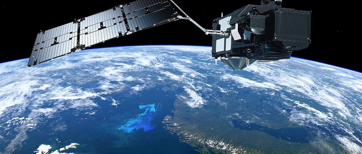
(Image courtesy of ESA)

Copernicus satellite

Course Overview

2.5 inchThis programme is one of two Swansea University courses which are among the first postgraduate qualifications to be awarded accreditation by the Royal Geographical Society.

The MSc in Geographic Information and Climate Change gives cross-disciplinary training in the scientific basis of GIS, satellite remote sensing and earth system modelling, alongside aspects of climate change.

You will concentrate on the technical aspects of GIS and earth observation, as well as the past, present and future global and regional environmental and climatic change.

By graduation you will have hands-on experience and technical knowledge in GIS and remote sensing, supported by a broad knowledge of scientific issues underpinning climate change.

Your learning benefits from the combined Geography and Biosciences research expertise of our staff around geographic information, environmental and climate dynamics, marine and ecosystem biology, and sustainable development.

Why Geographic Information and Climate Change at Swansea?

  • Top 100 in the World (Shanghai Ranking Subject Rankings 2024)
  • Top 201-250 in the World for Environmental Sciences (QS World University Rankings 2025)
  • 90% of our research outputs have been recognised as world-leading and internationally excellent - Research Excellence Framework (REF) 2021
  • 100% of the environment was rated as world-leading and internationally excellent - Research Excellence Framework (REF) 2021

You will be taught by a range of inspiring experts in environmental dynamics and climate change. These include Professor Adrian luckman who earned global media coverage for climate change research into the collapse of the Larsen C ice shelf; Professor Peter North who has collaborated with NASA on the ‘greening-up’ of the Amazon; and Professor Siwan Davies whose work focuses on establishing why climate change has changed abruptly over the past 100,000 years through the investigation of volcanic ash deposits trapped in ice sheets.

Read more about our accreditation

Your Geographic Information and Climate Change Experience

Over the course of study you acquire a deep knowledge of the current scientific issues underpinning geographic data, climate change and environmental dynamics. 

Our exceptional computing facilities support your studies from start to finish. These include fifteen dual-processor workstations for Earth Observation, a 20-node multiprocessor Beowulf cluster, and the Department’s IBM ‘Blue Ice’ supercomputer, which is mainly used for climate and glaciological modelling.

Upon graduation you will have developed the practical problem-solving and communication skills needed for a successful career in the wider industry.

Geographic Information and Climate Change Employment Opportunities

The MSc in Geographic Information & Climate change improves your prospects for a rewarding career.

You will have employment opportunities in utilities, county councils, the environmental service industry or regulating bodies. A future career in academia will also be open to you.

Our graduates have progressed to a range of stimulating roles. Below are just a few examples.

  • Environmental Monitoring Officer (Natural Resources Wales)
  • Geographical Data Processor (Western Power Distribution)
  • Graduate Statutory Orders Specialist (Jacobs)
  • Catchment Scientist (Welsh Water)
  • Ecologist (Natural England)
  • Multi-site Supervisor (Phase Eight)
  • Data Analyst (PHS Group)
  • Account Manager Support (Handelsbanken)

"Thank you for a great year under tough times. I really enjoyed the course and expanding my geographical knowledge. The two modules that were most challenging but the most beneficial to me were the GIS module and the modelling earth systems (hydrology).

The dissertation was extremely challenging. However, the support given throughout was fantastic, and I couldn't be more thankful.

Despite the second lockdown and the doom and gloom on the job markets, I have secured a contract job for a company called Cyient as a GIS Technician mapping land use changes for small scale rural and agricultural businesses. The project is for DEFRA for a period of 6 months, but hopefully I can progress and find another similar role after this.

Owen Lauder | GIS Technician

“I’d like to thank everyone in the department for running a course that has enabled me to get a job I love. It wouldn’t have been possible without my Master’s degree!”

Rhys Jones | Graduate Statutory Orders Specialist

Modules

The first part of this MSc contains compulsory and optional 20-credit modules on subjects such as modelling earth systems, satellite remote sensing and climate science and policy. The second part exclusively involves a 60-credit research project module on geographic information and climate change.

We reserve the right to change the options available each year.